

How to Track a Live Pattern Through Trump’s Executive Orders
Observing how this hurricane season may reveal federal and state patterns.

📌 All non-urgent posts are available to free subscribers one week after publication, for a 7-day window. If you’d like to read this — and future posts — right away (and access the full archive) you’re warmly invited to upgrade to a premium subscription.
Dear friends,
I'm still putting the finishing touches to the wildfire action resources I promised to share, and I have some personal admin that urgently needs my attention. But briefly, I'd like to invite you into my thinking process, because right now, we have a chance to test — in real time — whether the patterns I'm mapping are accurate and reliable.
I’m placing this analysis in open view not because I think I’ve cracked it, but because I trust the patterns I’m tracking. If you want to be able to follow those same patterns, the best way I can support that is by showing the working as it unfolds. (And I’d like to quietly reassure those readers who have wondered if I’m just being paranoid.)
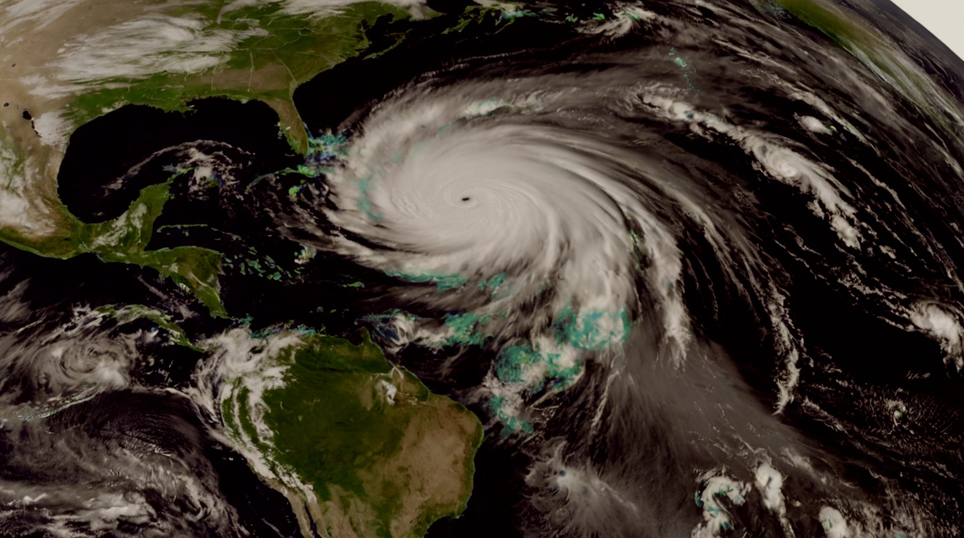
Today, the United States has officially cut off access to critical weather satellite data — the same data that’s been used for decades to track hurricanes as they form, intensify, and approach land. This isn’t a minor disruption. It’s the deliberate shutdown of the Defense Meteorological Satellite Program’s microwave imagery, right at the start of what’s already shaping up to be a dangerous hurricane season.
Why does this matter? Because this data is what helps forecasters see inside storms — especially at night, and especially when hurricanes rapidly strengthen. Without it, We the People will be flying blind through hurricane season, with communities now facing greater risk with less warning. I want to show that this shift didn’t happen by accident — it’s a policy decision with real, immediate consequences.
Given the patterns already emerging from Trump’s wildfire executive orders — and now this sudden satellite data shutdown — I’m going to stick my neck out. I think it’s highly likely that a hurricane-focused Executive Order is coming soon, and probably before the peak of the 2025 hurricane season, which usually hits between August and October.
If we follow Trump’s operational rhythm, a few things stand out.
First, he tends to issue executive orders in response to media attention or political opportunity. The international press, national meteorologists, and now news are all sounding the alarm about the collapse of hurricane forecasting capacity. This sets the stage for a classic performative “rescue” where Trump manufactures the problem, then rushes in as the solution.
Second, there’s mounting deadline pressure. Trump has already missed the first major milestone from the March executive order — the National Resilience Strategy was due by mid-June, and as of today, there’s no public evidence it’s been delivered. But another key deadline is coming fast: by July 12, federal agencies must have fully coordinated their wildfire strategies, including the realignment of military assets. Missing the June deadline increases the likelihood that Trump will move quickly on the next piece — and a hurricane-focused executive order would be a perfectly timed pivot. It would let him capitalise on public concern, while using the July coordination deadline as a springboard for a visibly centralised federal response.
Third, the infrastructure is already being shifted. The Department of Defense still controls the satellites. The Navy’s role in shutting down the DMSP feed points to a broader realignment of data control — pulling critical forecasting tools back into more tightly held, potentially less transparent federal channels. Trump may now position this as a reason to consolidate hurricane response under federal authority, framed of course as public safety.
